
Hobson City, Alabama
Hobson City, Alabama | |
|---|---|
 Seal | |
 Location of Hobson City in Calhoun County, Alabama. | |
| Coordinates: 33°37′7″N 85°50′36″W / 33.61861°N 85.84333°W | |
| Country | United States |
| State | Alabama |
| County | Calhoun |
| Government | |
| • Mayor | Alberta McCrory |
| Area | |
• Total | 1.05 sq mi (2.71 km2) |
| • Land | 1.05 sq mi (2.71 km2) |
| • Water | 0.00 sq mi (0.00 km2) |
| Elevation | 728 ft (222 m) |
| Population (2020) | |
• Total | 759 |
| • Density | 725.62/sq mi (280.25/km2) |
| Time zone | UTC-6 (Central (CST)) |
| • Summer (DST) | UTC-5 (CDT) |
| ZIP | 36201 |
| FIPS code | 01-35152 |
| GNIS feature ID | 0159780 |
| Website | http://www.townofhobsoncity.com/ |
Hobson City is a town in Calhoun County, Alabama, United States. At the 2020 census, the population was 759. It is included in the Anniston-Oxford Metropolitan Statistical Area. Hobson City became Alabama's first self-governed all-black municipality[2] in 1899 and continues to have an African American majority.
The town of Hobson City, originally known as Mooree Quarters, was a Black settlement established in 1868 within a section of Oxford, Alabama. In 1890, a pivotal moment occurred when a Black man ran for Justice of the Peace in Oxford. Mayor Whitehead threatened that if the Black candidate won, he would redraw the town’s boundary lines to exclude Mooree Quarters. When the Black man won the election, the threat was carried out, and in 1896, Mooree Quarters was officially removed from Oxford’s town limits.
Under the 1899 Alabama Constitution, voting eligibility was restricted by stringent requirements, including being a male over 21, owning at least 40 acres of land, paying taxes, holding a steady job for 12 months, and being able to read and understand the Constitution. Despite these barriers, some Black property owners met the criteria and were permitted to vote in local elections. Twenty such men, who qualified under these terms, played a key role in the incorporation of the town.
For nearly three years, Mooree Quarters existed as an unincorporated settlement within the county. Determined to take control of their future, a committee of residents sought the advice of attorney Ross Black in Anniston, Alabama. At the time, Black attorneys were barred from practicing law in the state. Ross Black recommended that the community incorporate their territory into an independent municipality. On July 20, 1899, approximately 125 Black residents of Mooree Quarters submitted a petition to Calhoun County Probate Judge E. F. Cook, requesting to establish their own distinct town. After completing the necessary legal steps, the town was officially incorporated on August 16, 1899, becoming the first city in Alabama founded solely by and for Black citizens. S. L. Davis was elected as Hobson City’s first mayor. The town was named in honor of Richard P. Hobson, a white naval hero of the Spanish-American War and a member of the Alabama Legislature.
The town was incorporated on August 16, 1899.[3] Records from a contemporary Alabama newspaper, The Peoples' Journal, described the municipality as "the only municipality controlled and governed entirely by colored people anywhere in the United States." The newspaper further commented, "The whole country will doubtless be interested in the result of this experiment." Under the leadership of the first mayor, S. L. Davis, and the first police chief, James Duran, police protection was restored to the area. The town was named after Richmond P. Hobson, a white naval hero in the then-recent Spanish-American War and member of Congress. Newman O'Neal was the mayor in 1919 until he faced death threats and was assaulted by the Ku Klux Klan forcing him to flee the city.
The mayor in 1970, J. R. Striplin, was its thirteenth black mayor in succession.[3] The town has buildings listed on the National Register of Historic Places.
Geography
[edit]Hobson City is located in southern Calhoun County at 33°37'6.589" North, 85°50'36.330" West (33.618497, -85.843425).[4] It is bordered by the city of Oxford to the south and the city of Anniston to the north. According to the U.S. Census Bureau, the town has a total area of 1.0 square mile (2.7 km2), all land.[5]
Demographics
[edit]| Census | Pop. | Note | %± |
|---|---|---|---|
| 1900 | 292 | — | |
| 1910 | 344 | 17.8% | |
| 1920 | 371 | 7.8% | |
| 1930 | 404 | 8.9% | |
| 1940 | 508 | 25.7% | |
| 1950 | 672 | 32.3% | |
| 1960 | 770 | 14.6% | |
| 1970 | 1,124 | 46.0% | |
| 1980 | 1,268 | 12.8% | |
| 1990 | 794 | −37.4% | |
| 2000 | 878 | 10.6% | |
| 2010 | 771 | −12.2% | |
| 2020 | 759 | −1.6% | |
| U.S. Decennial Census[6] 2013 Estimate[7] | |||
2020 census
[edit]| Race / Ethnicity | Pop 2010[8] | Pop 2020[9] | % 2010 | % 2020 |
|---|---|---|---|---|
| White alone (NH) | 96 | 96 | 12.45% | 12.65% |
| Black or African American alone (NH) | 658 | 612 | 85.34% | 80.63% |
| Native American or Alaska Native alone (NH) | 0 | 3 | 0.00% | 0.40% |
| Asian alone (NH) | 3 | 2 | 0.39% | 0.26% |
| Pacific Islander alone (NH) | 0 | 0 | 0.00% | 0.00% |
| Some Other Race alone (NH) | 0 | 0 | 0.00% | 0.00% |
| Mixed Race/Multi-Racial (NH) | 4 | 34 | 0.52% | 4.48% |
| Hispanic or Latino (any race) | 10 | 12 | 1.30% | 1.58% |
| Total | 771 | 759 | 100.00% | 100.00% |
2000 census
[edit]As of the census[10] of 2000, there were 878 people, 363 households, and 242 families residing in the town. The population density was 802.8 inhabitants per square mile (310.0/km2). There were 415 housing units at an average density of 379.5 per square mile (146.5/km2). The racial makeup of the town was 92.71% Black, 6.15% White, 0.23% from other races, and 0.91% from two or more races. 0.57% of the population were Hispanic or Latino of any race.
There were 363 households, out of which 30.0% had children under the age of 18 living with them, 26.2% were married couples living together, 35.3% had a female householder with no husband present, and 33.1% were non-families. 29.8% of all households were made up of individuals, and 10.5% had someone living alone who was 65 years of age or older. The average household size was 2.42 and the average family size was 2.99.
In the town, the age distribution of the population shows 28.6% under the age of 18, 8.2% from 18 to 24, 29.0% from 25 to 44, 23.0% from 45 to 64, and 11.2% who were 65 years of age or older. The median age was 35 years. For every 100 females, there were 76.0 males. For every 100 females age 18 and over, there were 71.3 males.
The median income for a household in the town was $17,589, and the median income for a family was $20,368. Males had a median income of $21,667 versus $19,583 for females. The per capita income for the town was $8,992. About 30.7% of families and 30.2% of the population were below the poverty line, including 42.7% of those under age 18 and 15.5% of those age 65 or over.
References
[edit]- ^ "2020 U.S. Gazetteer Files". United States Census Bureau. Retrieved October 29, 2021.
- ^ "Alabama's oldest black city fading away". Lodi News-Sentinel. May 26, 2009. p. 12. Retrieved May 29, 2015.
- ^ a b Edmonds 1971, p. 231.
- ^ "US Gazetteer files: 2010, 2000, and 1990". United States Census Bureau. February 12, 2011. Retrieved April 23, 2011.
- ^ "Geographic Identifiers: 2010 Demographic Profile Data (G001): Hobson City town, Alabama". U.S. Census Bureau, American Factfinder. Archived from the original on February 12, 2020. Retrieved June 2, 2014.
- ^ "U.S. Decennial Census". Census.gov. Retrieved June 6, 2013.
- ^ "Annual Estimates of the Resident Population: April 1, 2010 to July 1, 2013". Archived from the original on May 22, 2014. Retrieved June 3, 2014.
- ^ "P2 HISPANIC OR LATINO, AND NOT HISPANIC OR LATINO BY RACE – 2010: DEC Redistricting Data (PL 94-171) – Hobson City town, Alabama". United States Census Bureau.
- ^ "P2 HISPANIC OR LATINO, AND NOT HISPANIC OR LATINO BY RACE – 2020: DEC Redistricting Data (PL 94-171) – Hobson City town, Alabama". United States Census Bureau.
- ^ "U.S. Census website". United States Census Bureau. Retrieved January 31, 2008.
- Edmonds, Helen G. (1971). Black faces in high places: Negroes in government. Harcourt Brace Jovanovich. ISBN 9780153710735. - Total pages: 277
External links
[edit]33°37′07″N 85°50′36″W / 33.618497°N 85.843425°W
Municipalities and communities of Calhoun County, Alabama, United States | ||
|---|---|---|
| Cities | 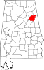 | |
| Towns | ||
| CDPs | ||
| Unincorporated communities | ||
| Ghost town | ||
| Footnotes | ‡This populated place also has portions in an adjacent county or counties | |