
Kenosha County, Wisconsin
Kenosha County | |
|---|---|
 The Kenosha County Courthouse and Jail in Kenosha | |
 Location within the U.S. state of Wisconsin | |
 Wisconsin's location within the U.S. | |
| Coordinates: 42°35′15″N 87°52′48″W / 42.587526°N 87.879996°W | |
| Country | |
| State | |
| Founded | January 30, 1850 |
| Seat | Kenosha |
| Largest city | Kenosha |
| Area | |
• Total | 754.025 sq mi (1,952.92 km2) |
| • Land | 271.833 sq mi (704.04 km2) |
| • Water | 482.192 sq mi (1,248.87 km2) 63.95% |
| Population (2020) | |
• Total | 169,151 |
• Estimate (2024) | 168,754 |
| • Density | 92.549/sq mi (35.733/km2) |
| Time zone | UTC−6 (Central) |
| • Summer (DST) | UTC−5 (CDT) |
| Area code | 262 |
| Congressional district | 1st |
| Website | kenoshacountywi.gov |
Kenosha County (/kəˈnoʊʃə/ ⓘ) is located in the southeastern corner of the U.S. state of Wisconsin. As of the 2020 census, the population was 169,151,[1] and was estimated to be 168,754 in 2024,[2] making it the eighth-most populous county in Wisconsin. Its county seat and the largest city is Kenosha.[3][4] the fourth-largest city in Wisconsin.
Kenosha County is situated on the southwestern shore of Lake Michigan. It is part of the Chicago metropolitan area.[5] The county has a direct rail link to Chicago via Metra's Union Pacific North Line. In 2022, Kenosha County was ranked 16th out of 72 Wisconsin counties for tourism revenue, at $424 million in 2022.[6]
History
[edit]The Potowatomi inhabited the area that would become Kenosha County for centuries prior to the acquisition of the area in 1833. The city of Kenosha was founded in 1835, and Kenosha County was formed from Racine County on January 30, 1850.[7][8] Its location led to development and factories being built in the 19th century. Manufacturing continued to be a key component of the economy into the 20th century.[9]
Geography
[edit]According to the United States Census Bureau, the county has a total area of 754.025 square miles (1,952.92 km2), of which 271.833 square miles (704.04 km2) is land and 482.192 square miles (1,248.87 km2) (63.95%) is water.[10] It is the 69th largest county in Wisconsin by total area (fourth-smallest county). Although the county contains area from Lake Michigan.[11]
Major highways
[edit]Railroads
[edit]Buses
[edit]Airport
[edit]Kenosha Regional Airport (KENW) serves the county and surrounding communities.
Adjacent counties
[edit]- Racine County (north)
- Allegan County, Michigan (east across Lake Michigan)
- Lake County, Illinois (south)
- McHenry County, Illinois (southwest)
- Walworth County (west)
Demographics
[edit]| Census | Pop. | Note | %± |
|---|---|---|---|
| 1850 | 10,734 | — | |
| 1860 | 13,900 | 29.5% | |
| 1870 | 13,147 | −5.4% | |
| 1880 | 13,550 | 3.1% | |
| 1890 | 15,581 | 15.0% | |
| 1900 | 21,707 | 39.3% | |
| 1910 | 32,929 | 51.7% | |
| 1920 | 51,284 | 55.7% | |
| 1930 | 63,277 | 23.4% | |
| 1940 | 63,505 | 0.4% | |
| 1950 | 75,238 | 18.5% | |
| 1960 | 100,615 | 33.7% | |
| 1970 | 117,917 | 17.2% | |
| 1980 | 123,137 | 4.4% | |
| 1990 | 128,181 | 4.1% | |
| 2000 | 149,577 | 16.7% | |
| 2010 | 166,426 | 11.3% | |
| 2020 | 169,151 | 1.6% | |
| 2024 (est.) | 168,754 | [12] | −0.2% |
| U.S. Decennial Census[13] 1790–1960[14] 1900–1990[15] 1990–2000[16] 2010–2020[2] | |||
As of the third quarter of 2024, the median home value in Kenosha County was $284,600.[17]
As of the 2023 American Community Survey, there are 67,631 estimated households in Kenosha County with an average of 2.43 persons per household. The county has a median household income of $79,412. Approximately 11.3% of the county's population lives at or below the poverty line. Kenosha County has an estimated 67.0% employment rate, with 30.8% of the population holding a bachelor's degree or higher and 95.0% holding a high school diploma.[2]
The top five reported ancestries (people were allowed to report up to two ancestries, thus the figures will generally add to more than 100%) were English (85.8%), Spanish (9.5%), Indo-European (3.3%), Asian and Pacific Islander (0.9%), and Other (0.5%).
The median age in the county was 39.5 years.
Kenosha County, Wisconsin – racial and ethnic composition
Note: the US Census treats Hispanic/Latino as an ethnic category. This table excludes Latinos from the racial categories and assigns them to a separate category. Hispanics/Latinos may be of any race.
| Race / ethnicity (NH = non-Hispanic) | Pop. 1980[18] | Pop. 1990[19] | Pop. 2000[20] | Pop. 2010[21] | Pop. 2020[22] |
|---|---|---|---|---|---|
| White alone (NH) | 115,691 (93.95%) |
116,223 (90.67%) |
127,287 (85.10%) |
129,892 (78.08%) |
121,936 (72.09%) |
| Black or African American alone (NH) | 2,850 (2.31%) |
5,190 (4.05%) |
7,446 (4.98%) |
10,655 (6.40%) |
11,480 (6.79%) |
| Native American or Alaska Native alone (NH) | 349 (0.28%) |
443 (0.35%) |
491 (0.33%) |
513 (0.31%) |
371 (0.22%) |
| Asian alone (NH) | 401 (0.33%) |
652 (0.51%) |
1,350 (0.90%) |
2,343 (1.41%) |
2,793 (1.65%) |
| Pacific Islander alone (NH) | — | — | 53 (0.04%) |
67 (0.04%) |
67 (0.04%) |
| Other race alone (NH) | 268 (0.22%) |
93 (0.07%) |
160 (0.11%) |
177 (0.11%) |
528 (0.31%) |
| Mixed race or multiracial (NH) | — | — | 2,033 (1.36%) |
3,187 (1.91%) |
7,430 (4.39%) |
| Hispanic or Latino (any race) | 3,578 (2.91%) |
5,580 (4.35%) |
10,757 (7.19%) |
19,592 (11.77%) |
24,546 (14.51%) |
| Total | 123,137 (100.00%) |
128,181 (100.00%) |
149,577 (100.00%) |
166,426 (100.00%) |
169,151 (100.00%) |
2023 estimate
[edit]As of the 2023 estimate, there were 167,488 people and 67,631 households residing in the county. There were 73,786 housing units. The racial makeup of the county was 86.3% White (72.8% NH White), 7.7% African American, 0.8% Native American, 2.0% Asian, 0.1% Pacific Islander, _% from some other races and 3.1% from two or more races. Hispanic or Latino people of any race were 15.4% of the population.[23]
2020 Census
[edit]As of the 2020 census, there were 169,151 people, 66,842 households, and 42,891 families residing in the county.[24] The population density was 622.3 inhabitants per square mile (240.3/km2). There were 72,451 housing units at an average density of 266.5 per square mile (102.9/km2). The racial makeup of the county was 75.92% White, 7.14% African American, 0.43% Native American, 1.70% Asian, 0.05% Pacific Islander, 5.24% from some other races and 9.52% from two or more races. Hispanic or Latino people of any race were 14.51% of the population.[25]
2010 census
[edit]As of the 2010 census, there were 166,426 people, 62,650 households, and _ families residing in the county. The population density was 611.9 inhabitants per square mile (236.3/km2). There were 69,288 housing units at an average density of 254.7 per square mile (98.3/km2). The racial makeup of the county was 83.77% White, 6.64% African American, 0.49% Native American, 1.44% Asian, 0.05% Pacific Islander, 4.73% from some other races and 2.87% from two or more races. Hispanic or Latino people of any race were 11.77% of the population.
2000 census
[edit]
As of the 2000 census, there were 149,577 people, 56,057 households, and 38,455 families residing in the county. The population density was 548.0 inhabitants per square mile (211.6/km2). There were 59,989 housing units at an average density of 220.0 per square mile (84.9/km2). The racial makeup of the county was 88.38% White, 5.08% African American, 0.38% Native American, 0.92% Asian, 0.04% Pacific Islander, 3.29% from some other races and 1.91% from two or more races. Hispanic or Latino people of any race were 7.19% of the population.
In terms of ancestry, 28.8% were of German, 10.4% Italian, 7.9% Irish, 7.6% Polish and 7.5% English.
There were 56,057 households, out of which 34.80% had children under the age of 18 living with them, 52.70% were married couples living together, 11.50% had a female householder with no husband present, and 31.40% were non-families. 25.50% of all households were made up of individuals, and 9.10% had someone living alone who was 65 years of age or older. The average household size was 2.60 and the average family size was 3.13.
In the county, the population was spread out, with 27.10% under the age of 18, 9.40% from 18 to 24, 31.30% from 25 to 44, 20.70% from 45 to 64, and 11.50% who were 65 years of age or older. The median age was 35 years. For every 100 females, there were 98.30 males. For every 100 females age 18 and over, there were 95.30 males.
Government
[edit]The county legislature is known as the Board of Supervisors. It consists of 23 members, each elected from single-member districts. The county executive is elected in a spring countywide, nonpartisan vote. The county executive is Samantha Kerkman.[26] The district attorney, treasurer, clerk, and register of deeds are elected in fall countywide, partisan elections held in presidential years, while the sheriff and clerk of circuit court are elected in fall countywide, partisan elections held in gubernatorial years.
Politics
[edit]In presidential elections, Kenosha County has voted Democratic for most of the past century. In 2016, Donald Trump became the first Republican presidential candidate to win the county since President Nixon in 1972. In 2020 and 2024, Trump was able to gain more of the vote share with 2024 being the highest share for a Republican since 1972.
| Year | Republican | Democratic | Third party(ies) | |||
|---|---|---|---|---|---|---|
| No. | % | No. | % | No. | % | |
| 2024 | 47,478 | 52.36% | 41,826 | 46.12% | 1,376 | 1.52% |
| 2020 | 44,972 | 50.68% | 42,193 | 47.55% | 1,573 | 1.77% |
| 2016 | 36,037 | 47.23% | 35,799 | 46.92% | 4,468 | 5.86% |
| 2012 | 34,977 | 43.24% | 44,867 | 55.46% | 1,053 | 1.30% |
| 2008 | 31,609 | 40.12% | 45,836 | 58.18% | 1,344 | 1.71% |
| 2004 | 35,587 | 46.56% | 40,107 | 52.48% | 734 | 0.96% |
| 2000 | 28,891 | 45.35% | 32,429 | 50.90% | 2,389 | 3.75% |
| 1996 | 18,296 | 34.06% | 27,964 | 52.06% | 7,457 | 13.88% |
| 1992 | 19,854 | 32.11% | 27,341 | 44.21% | 14,642 | 23.68% |
| 1988 | 21,661 | 41.55% | 30,089 | 57.72% | 379 | 0.73% |
| 1984 | 26,118 | 46.89% | 29,233 | 52.49% | 344 | 0.62% |
| 1980 | 24,481 | 43.82% | 26,738 | 47.86% | 4,644 | 8.31% |
| 1976 | 22,349 | 43.61% | 27,585 | 53.82% | 1,316 | 2.57% |
| 1972 | 24,041 | 53.93% | 19,441 | 43.61% | 1,094 | 2.45% |
| 1968 | 17,089 | 40.57% | 21,427 | 50.86% | 3,610 | 8.57% |
| 1964 | 14,764 | 32.55% | 30,522 | 67.29% | 70 | 0.15% |
| 1960 | 19,969 | 46.43% | 22,956 | 53.37% | 86 | 0.20% |
| 1956 | 21,367 | 55.08% | 17,094 | 44.06% | 335 | 0.86% |
| 1952 | 18,917 | 48.72% | 19,768 | 50.91% | 142 | 0.37% |
| 1948 | 12,780 | 39.80% | 17,987 | 56.02% | 1,342 | 4.18% |
| 1944 | 12,436 | 39.96% | 18,325 | 58.88% | 360 | 1.16% |
| 1940 | 12,182 | 40.91% | 17,174 | 57.68% | 421 | 1.41% |
| 1936 | 7,268 | 26.68% | 18,137 | 66.57% | 1,840 | 6.75% |
| 1932 | 7,307 | 30.57% | 14,373 | 60.13% | 2,223 | 9.30% |
| 1928 | 11,330 | 50.66% | 10,638 | 47.57% | 395 | 1.77% |
| 1924 | 10,341 | 55.45% | 1,517 | 8.13% | 6,791 | 36.41% |
| 1920 | 9,791 | 77.81% | 1,724 | 13.70% | 1,069 | 8.49% |
| 1916 | 3,537 | 50.99% | 2,813 | 40.55% | 587 | 8.46% |
| 1912 | 1,671 | 27.21% | 2,216 | 36.09% | 2,254 | 36.70% |
| 1908 | 3,409 | 54.50% | 2,006 | 32.07% | 840 | 13.43% |
| 1904 | 3,293 | 60.86% | 1,592 | 29.42% | 526 | 9.72% |
| 1900 | 3,078 | 58.37% | 2,101 | 39.84% | 94 | 1.78% |
| 1896 | 2,827 | 60.54% | 1,732 | 37.09% | 111 | 2.38% |
| 1892 | 1,628 | 44.71% | 1,928 | 52.95% | 85 | 2.33% |
Education
[edit]Libraries
[edit]Library services are provided by the Kenosha County Library System (KCLS), comprising the Kenosha Public Library (KPL), serving the city of Kenosha and the village of Pleasant Prairie, and the Community Library, which serves the town of Randall and the villages of Paddock Lake, Salem Lakes, and Twin Lakes.[28]
Communities
[edit]City
[edit]- Kenosha (county seat)
Villages
[edit]- Bristol
- Genoa City (mostly in Walworth County)
- Paddock Lake
- Pleasant Prairie
- Salem Lakes
- Somers
- Twin Lakes
Towns
[edit]Census-designated places
[edit]Unincorporated communities
[edit]Ghost towns/neighborhoods
[edit]See also
[edit]Notes
[edit]- ^ "Explore Census Data". United States Census Bureau. Retrieved April 24, 2025.
- ^ a b c "U.S. Census Bureau QuickFacts: Kenosha County, Wisconsin". www.census.gov. Retrieved April 24, 2025.
- ^ "Find a County". National Association of Counties. Retrieved April 24, 2025.
- ^ "Here's How Iron Got Its Name". The Rhinelander Daily News. June 16, 1932. p. 2. Archived from the original on September 3, 2014. Retrieved August 24, 2014 – via Newspapers.com.

- ^ Winck, Ben (August 1, 2021). "Forget the suburbs, the 'exurbs' are the place to be". businessinsider.com. Business Insider. Retrieved August 2, 2021.
- ^ "Record-Breaking Year for Kenosha County Tourism in 2022". Kenosha News. June 6, 2023. Retrieved June 8, 2023.
- ^ "Wisconsin: Individual County Chronologies". publications.newberry.org. The Newberry Library. 2008. Retrieved April 24, 2025.
- ^ "Kenosha County". Encyclopedia of Milwaukee. University of Wisconsin–Milwaukee. Retrieved April 27, 2022.
- ^ WHS Library Archives Staff (August 16, 2012). "A Brief History of Kenosha, Wisconsin". Wisconsin Historical Society. Archived from the original on March 25, 2018. Retrieved March 25, 2018.
- ^ "2024 County Gazetteer Files – Wisconsin". United States Census Bureau. Retrieved April 24, 2025.
- ^ "U.S. Census Bureau QuickFacts: Kenosha County, Wisconsin". www.census.gov. Retrieved April 24, 2025.
- ^ "County Population Totals and Components of Change: 2020-2024". Retrieved April 24, 2025.
- ^ "U.S. Decennial Census". United States Census Bureau. Retrieved July 20, 2014.
- ^ "Historical Census Browser". University of Virginia Library. 2007. Archived from the original on December 12, 2009. Retrieved July 20, 2014.
- ^ Forstall, Richard L. (March 27, 1995). "Population of Counties by Decennial Census: 1900 to 1990". United States Census Bureau. Archived from the original on February 19, 1999. Retrieved July 20, 2014.
- ^ "Census 2000 PHC-T-4. Ranking Tables for Counties: 1990 and 2000" (PDF). United States Census Bureau. Archived (PDF) from the original on March 27, 2010. Retrieved July 20, 2014.
- ^ "County Median Home Price". National Association of Realtors. Retrieved April 24, 2025.
- ^ "Kenosha County, Wisconsin — Population by Race". CensusScope. Retrieved April 24, 2025.
- ^ "1990 Census of Population: General Population Characteristics Wisconsin" (PDF). www.census.gov. October 6, 2022. p. 20. Retrieved April 24, 2025.
- ^ "P004: Hispanic or Latino, and Not Hispanic or Latino by Race – 2000: DEC Summary File 1 – Kenosha County, Wisconsin". United States Census Bureau. Retrieved April 24, 2025.
- ^ "P2: Hispanic or Latino, and Not Hispanic or Latino by Race – 2010: DEC Redistricting Data (PL 94-171) – Kenosha County, Wisconsin". United States Census Bureau. Retrieved April 24, 2025.
- ^ "P2: Hispanic or Latino, and Not Hispanic or Latino by Race – 2020: DEC Redistricting Data (PL 94-171) – Kenosha County, Wisconsin". United States Census Bureau. Retrieved April 24, 2025.
- ^ "County Population by Characteristics: 2020-2023". www.census.gov. United States Census Bureau. Retrieved April 24, 2025.
- ^ "US Census Bureau, Table P16: Household Type". United States Census Bureau. Retrieved April 24, 2025.
- ^ "How many people live in Kenosha County, Wisconsin". USA Today. Retrieved April 24, 2025.
- ^ "Samantha Kerkman: Republican County Executive Elected In Kenosha County". April 6, 2022. Retrieved February 29, 2024.
- ^ Leip, David. "Dave Leip's Atlas of U.S. Presidential Elections". uselectionatlas.org. Archived from the original on March 23, 2018. Retrieved November 11, 2020.
- ^ "Kenosha County Library System". Retrieved January 1, 2025.
References
[edit]- Forstall, Richard L., ed. (1996). Population of States and Counties of the United States: 1790 to 1990: From the Twenty-One Decennial Censuses. Washington, DC: United States Department of Commerce, Bureau of the Census, Population Division. ISBN 0-934213-48-8.
External links
[edit]- Official website

- Kenosha County map from the Wisconsin Department of Transportation
Places adjacent to Kenosha County, Wisconsin | |
|---|---|
Municipalities and communities of Kenosha County, Wisconsin, United States | ||
|---|---|---|
| City | 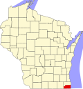 | |
| Villages | ||
| Towns | ||
| CDPs | ||
| Other communities | ||
| Former communities | ||
| Footnotes | ‡This populated place also has portions in an adjacent county or counties | |
| Major city |  | |
|---|---|---|
| Cities (over 30,000 in 2020) | ||
| Towns and villages (over 30,000 in 2020) |
| |
| Counties | ||
| Regions | ||
| Sub-regions | ||
| International | |
|---|---|
| National | |